Votre choix relatif aux cookies sur le site MOOVTOO.COM
Afin d’améliorer votre expérience sur MOOVTOO, nous utilisons des cookies. Certains cookies sont indispensables pour assurer une expérience utilisateur agréable et fluidifier votre navigation sur le site. D’autres sont facultatifs : utilisés dans un but marketing, ils nous permettent de conserver certaines informations de connexion (contenu de panier, pages visitées...), notamment pour vous proposer des contenus et services correspondants à vos centres d'intérêt. Vous pouvez choisir de refuser certains cookies : paramétrez vos choix selon les différentes catégories de cookies, puis cliquez sur Valider. Vous pourrez à tout moment modifier ce choix et consulter l’ensemble de notre politique de traitement des données personnelles à partir de cette page :
Données personnelles
Analyse des données
Nous utilisons ces cookies pour suivre et analyser votre navigation sur le site et la manière dont vous l’utiliser. Ils nous permettent de mesurer la performance de la plateforme, d’optimiser les contenus et la navigation, et d’améliorer la qualité des services proposés
Personnalisation de nos offres
Nous utilisons ces cookies pour personnaliser les bannières publicitaires publiées sur MOOVTOO, mais aussi les emails que nous vous adressons en fonction de votre navigation sur le site (relance suite à un panier abandonné, par exemple, ou à la consultation d’une offre spécifique).
Publicité sur des media tiers
Ces cookies nous permettent d’afficher sur des sites et media online externes à MOOVTOO du contenu publicitaire faisant la promotion de MOOVTOO et correspondant à vos centres d’intérêt.
Et revoilà les cookies !
La plateforme digitale MOOVTOO utilise des cookies. Certains d’entre eux ont un but marketing et nous permettent de personnaliser les contenus, les offres et les services qui vous sont suggérés. D’autres sont juste là pour fluidifier votre navigation. Vous n’êtes pas obligé de tous les accepter ! Pour en savoir plus, consultez l’ensemble de notre politique d’utilisation des cookies.
Consulter notre politique de confidentialité
Ce site est une version Bêta, en cours d’amélioration. Il n’est donc pas complet : certains contenus doivent encore être ajoutés, et les parcours utilisateur optimisés.
La mise en ligne de cette version Bêta nous permet de tester le site et de recueillir les commentaires (constructifs !) de la part de ses visiteurs, afin de lancer une première version aboutie de MOOVTOO.
x
beta
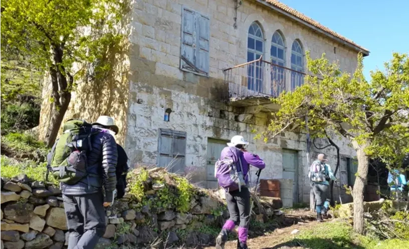
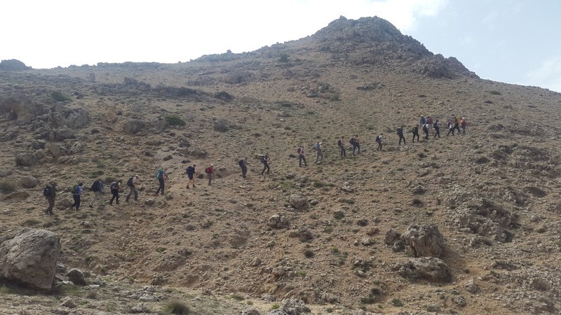
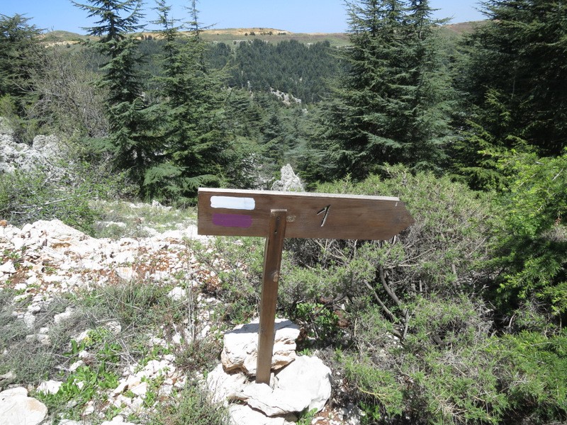
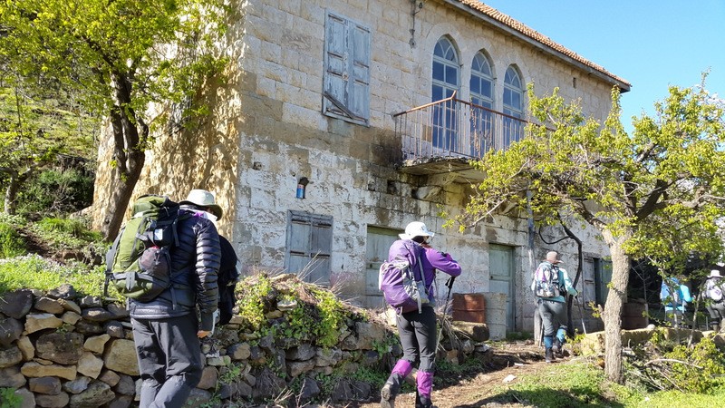
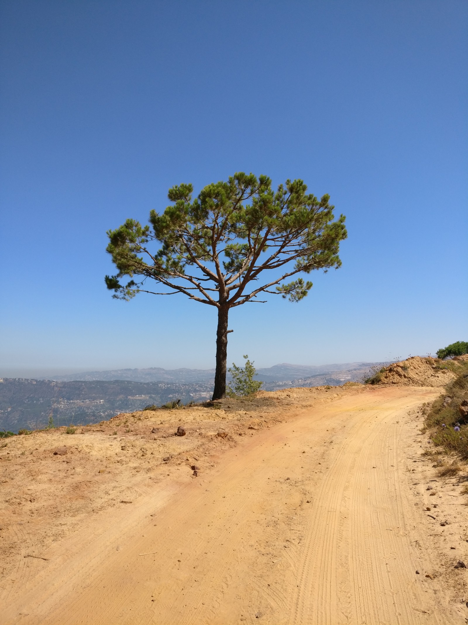
LMT Section 9: From Bazaoun to Tannourine el-Faouqa
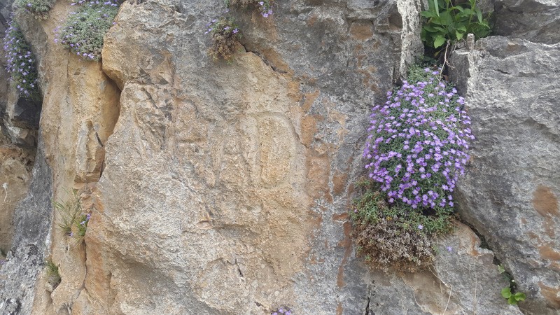
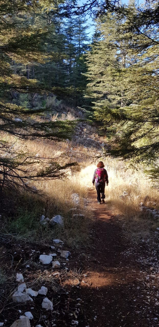
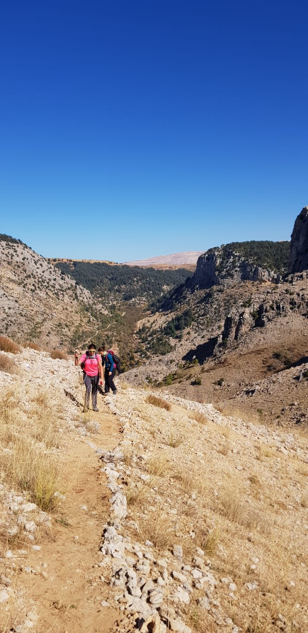
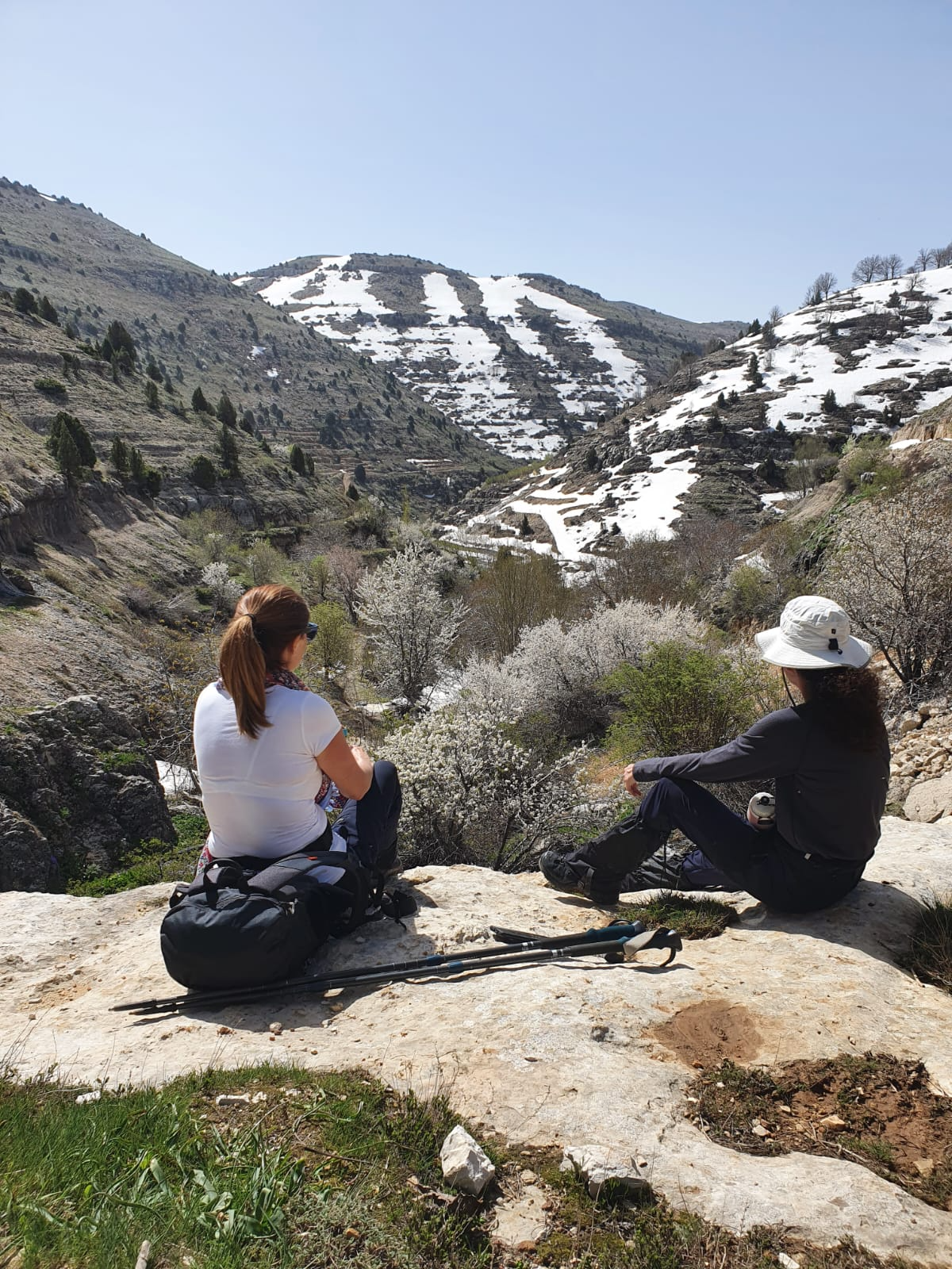
You can start near the Hotel Karam or go back to the head of the trail at the info panel and start walking towards Tannourine el Faouqa. Continue on the concrete water canal to reach Nabaa el Rassain spring and then walk along the road, passing several hill lakes and orchards. Keep walking past Ain el Ouatye and Ain el Dahab springs, passing by the hill lake of el Dimane and continuing towards Nbaa el Mrouj spring. Then go down a steep decent to the main paved road of Tannourine-el Hadath, crossing it and walking along the stream. You will pass by the Hadrian inscription before reaching the entrance to the Tannourine Cedar Nature Reserve. Walk downhill on trail number 1. Once you reach the road, turn left and continue as far as the dirt road goes before taking the footpath to Ain el Jaouze spring. From there, you walk along the trail before crossing the stream and continuing along the footpath until you start climbing towards Chir el Ribaz. When you pass the saddle, start walking down towards Nabaa el Korsi spring. Then follow the water canal until you reach the paved road. Walk down the stairs to end at Tannourine el Faouqa main square from where you can continue towards section 10.
Étapes & points d'intérêt
From Bazaoun to Tannourine el-Faouqa
Explore the different points of interest along the trail.